By connecting the Autodesk Construction Cloud and Esri's ArcGIS, owners, operators, and Architecture, Engineering & Construction (AEC) teams can use configurable apps to explore and collaborate on project information with geospatial context—easing communications and improving decisions throughout an asset’s lifecycle.
BIM and GIS cloud collaboration
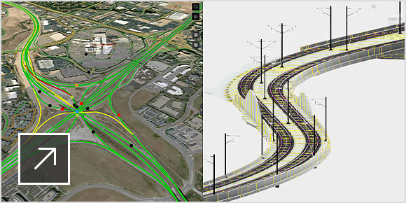
Bring project information and geospatial context together through a cloud-to-cloud connection between Building Information Modeling (BIM) and geographic information systems (GIS).
Work within a geospatial context
BIM and GIS cloud collaboration with ArcGIS GeoBIM (video: 2:25 min.)
ArcGIS GeoBIM+BIM Collaborate Pro overview (video: 2:21 min.)
ArcGIS GeoBIM and BIM Collaborate Pro
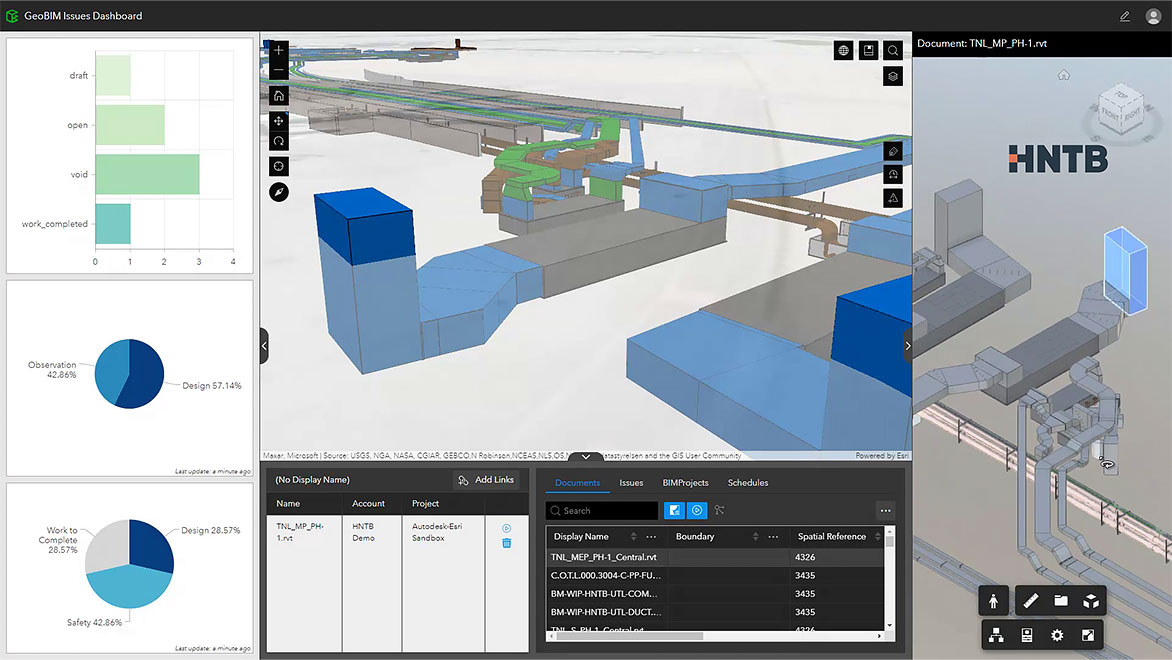
Visualize and evaluate project information in a web-based experience using ArcGIS GeoBIM and Autodesk BIM Collaborate Pro, allowing AEC teams to seamlessly collaborate and manage risks, costs, and timelines using data from multiple systems in a geospatial context.
What is ArcGIS GeoBIM from Esri?
What our customers say
“The connection between Esri’s ArcGIS GeoBIM and Autodesk’s BIM Collaborate Pro enables the coordination necessary for our teams to design within a real-world context as we factor in key surrounding data in our design.” –Darin Welch, Associate V.P., Geospatial and Virtual Engagement Solutions, HNTB
Image courtesy of HNTB Corporation
Cloud-connected use cases
Discover the value of integrating project information with geospatial context.
-
Design coordination
Link up-to-date project information with geospatial context for improved design review, visualization, and exploration.
-
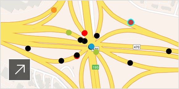
Issue clustering
Take advantage of a unified web environment for issue mapping and management.
-
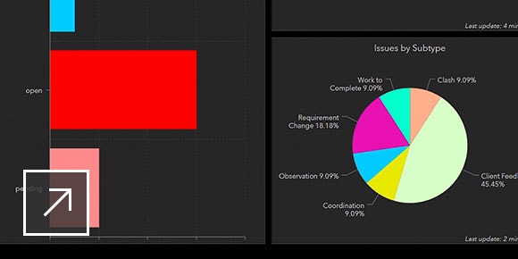
Performance dashboard
Understand and monitor project status, including issue locations, completion, timelines, and distribution across teams.
-
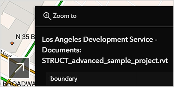
Documentation review
Connect documentation to relevant ArcGIS features for more efficient and secure access to the latest project updates.
Real value with cloud productivity
-
Explore assets in real space
Harness the fusion of BIM and geospatial through task-specific web apps.
-
Link disparate data silos
Keep BIM and GIS data within their source locations, minimize data conversion, and use a cloud-based connection to unite them via app-based experiences.
-
Collaborate and share with ease
Review and investigate project performance, status, and issues with easy-to-use applications as a team.
Let’s talk about BIM and GIS cloud collaboration
Learn more about ArcGIS GeoBIM and BIM Collaborate Pro. Simply fill in the form and one of our sales experts will contact you shortly.
